Long-sought new plan sets table for 51 miles of possibilities
On June 14, the Los Angeles County Board of Supervisors gets a new, 538-page master plan for the Los Angeles River.
“The Reimagined River” is the product of five years of study and discussion about how to upgrade the river’s place in the life of the community.
The plan has nine particular goals for the 51-mile river.
These include environmental targets, such as continued flood control protection, improvements in water quality and supply, and fostering healthy ecosystems, perhaps by reconnecting communities and land tracts the cement-enclosed stream currently divides.
Social goals include improved access for people in the dozens of cities and neighborhoods surrounding the river, along with improved parks, trails, and open spaces, and ensuring that access is available equitably.
The plan also has suggestions for minimizing the downside that sometimes comes with infrastructure improvements: people being displaced by new development plans, higher property values, and gentrification.
Also, the river is an opportunity for arts, culture, education, and community engagement that the plan hopes to promote.
Housing, homelessness & equitable access
But for all that, the Master Plan is only a menu, and its release May 17 is just “Day One” of a hoped-for transformation that will better integrate the river into the lives of the millions of people in its proximity.

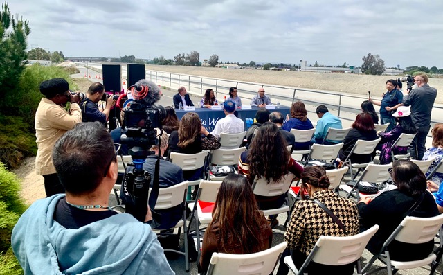
At a media briefing hosted by Ethnic Media Services and L.A. County Public Works that day, LACPW Deputy Director Keith Lilley was joined by Dr. Wilma Franco, of the Southeast Los Angeles Collaborative, Sissy Trinh, of the Southeast Asian Community Alliance, and Tensho Takemori, an architect with Gehry Partners, and others in discussing the master plan they drafted pursuant to a 2016 Board of Supervisors request for guiding the county’s relationship to the river for current and future generations.
It’s a lot more than the bike trails and signage agreements that came from the last time the county considered the river, back in 1996, Lilley noted.
For one thing, Trinh pointed out, “it’s probably the first infrastructure plan that addresses the top issue in the state — housing and homelessness.”
She and Franco discussed their emphasis on including all the diverse communities the river touches to ensure equitable access to its amenities and opportunities — including jobs — and in engaging communities who have traditionally ignored or feared the river, for numerous and understandable reasons.
Among the strategies the plan spells out for realizing some goals are ways to coordinate with state and federal government programs aimed at shared targets.
For instance, the county has already identified $50 million that may very soon become available from last year’s ARPA COVID recovery act to start a “land bank” effort that would acquire neighboring properties before river improvements boost their values out of reach.
Planners took lessons from other cities, such as New York, where the popular “Highline” project boosted a small urban area, but also had the effect of undermining the neighborhood community by boosting surrounding land values 20%, Takemori said.
Other projects, such as Atlanta’s “Beltway,” Austin, Texas’s “Riverwalk,” and Chicago’s “606” provided similar lessons, he said.
Planners worked to incorporate community suggestions gathered by members of its 41-person steering committee and through public community meetings, events coordinated with community partner organizations, and online forums.
‘Biggest body of research’ on L.A. River ever assembled
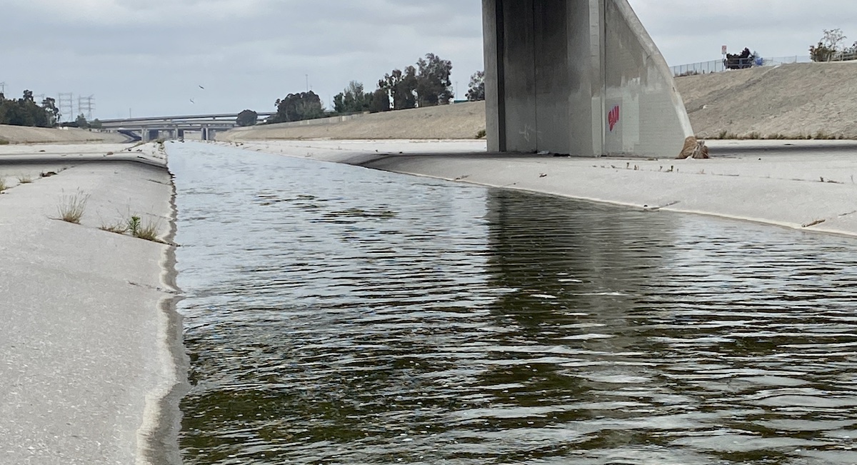
But the sky’s not the limit. If the decisions were being made now, it’s possible that flood control needs might be met some other way than by enclosing the water in cement culverts, said Jessica Henson of the landscape architect and urban design studio OLIN, one of the planners.
But that ship sailed long ago. There’s still a need for flood control, and without the culverts, the water would naturally spread much more widely — three to seven times as much — and into communities where people live. So generally, the plan doesn’t recommend tearing out the cement.
But nonetheless, she said, “we can do incredible things in the coming decade.”
The plan incorporates about 200 data sets, “the biggest body of research ever assembled on the L.A. River,” she said, to describe its every mile, and inform suggestions for priorities at different points along the way.
But the plan lists no particular projects, costs, or timelines. The decision-making process is left to those elected to the County Board of Supervisors — and to the people who elected them.
“We’ve done extensive engagement,” Lilley acknowledged, but with the possibility of impacting millions of people, there’s room for more.
To best influence the river’s future, Henson suggested getting together with neighbors rather than going it alone, to work with local elected city and county representatives.
The plan is available online at www.LARiverMasterPlan.org


